Two numbers do most of the work here. The TECO Line Streetcar costs nothing and has done since 2018. A HART bus costs $2.00 a ride with a $4.00 cap for the whole day — so two rides and the rest of the day is free. Understanding getting around tampa mostly means knowing which of the region’s several disconnected systems you are standing next to, because the difference between the best and worst way to make the same trip here is not twenty minutes, it is a free ride versus a $40 one.
It also means knowing what is not running. The seasonal Cross-Bay Ferry that half the internet still describes as an option stopped service on 30 April 2025. A replacement is coming. It is not here yet. We will come back to that.
Short answer: which mode for which trip
| Trip | Best mode | Cost | Honest note |
|---|---|---|---|
| Downtown ↔ Ybor City | TECO Line Streetcar | Free | Every 15 min, ~25 min end to end. No reason to do anything else. |
| Along the Riverwalk | Walk | Free | 2.6 miles, flat, paved, open 24 hours |
| Around Hillsborough County | HART bus | $2.00, $4 daily cap | Coverage is real; frequency is the weak point |
| Downtown ↔ Busch Gardens | Car or rideshare | Varies | No transit a visitor would tolerate |
| Tampa ↔ St. Petersburg | Car | Fuel; I-275 is free | The ferry is not currently an option |
| Tampa ↔ Clearwater Beach | Car | Fuel plus $3.50/hr beach parking | 20–25 miles from the airport, over a causeway |
| A night out downtown | Streetcar, then rideshare | Free, then surge | Streetcar stops at 2am Fri/Sat; last call is 3am |
| Airport transfers | See the airport guide | $40 flat by taxi | Covered in detail in our TPA guide |
The structural truth underneath that table: Tampa Bay is a genuinely car-dependent region with two or three excellent exceptions. The exceptions — the free streetcar, the Riverwalk, Bayshore Boulevard — are concentrated in a small area, and they are good enough that a downtown-based visitor can skip the rental car entirely. Outside that area, you drive.
The free tier
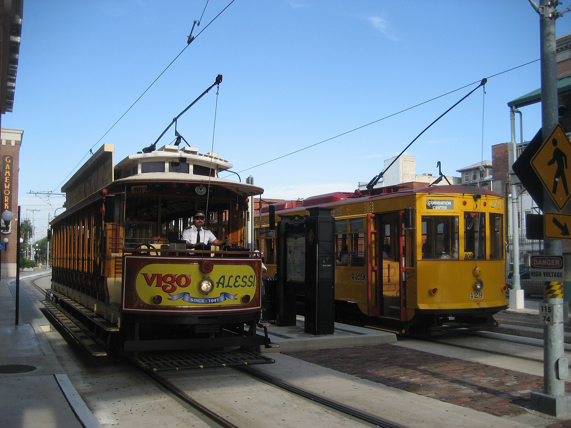
The TECO Line Streetcar
The single best piece of transit infrastructure for a visitor in this region, and it is free.
- Fare-free since 2018. No ticket, no tap, no app. Board and sit down.
- 11 stations, running from Centennial Park in Ybor City through the Channel District to Hattricks in downtown Tampa.
- A car every 15 minutes, and about 25 minutes end to end.
- Hours: Monday to Thursday 7am–11pm; Friday 7am–2am; Saturday 9am–2am; Sunday 8:30am–11pm.
It connects the three parts of Tampa a visitor most wants to be in — downtown, the Channel District and Ybor City — which covers the museums, the aquarium, Benchmark International Arena (called Amalie Arena until August 2025), the cruise terminals and the late-night district. If your trip fits on this line, your transport problem is solved and your transport budget is zero.
Its one real failure is the weekend timetable against the city’s own drinking laws: the last car is at 2am on Friday and Saturday, and last call in the City of Tampa is 3am. Midweek the gap is four hours.
Walking, which works better than you would expect in exactly two places
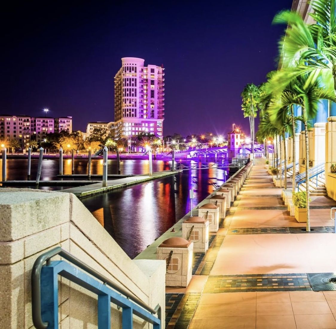
The Tampa Riverwalk runs 2.6 miles along the Hillsborough River from Armature Works in Tampa Heights to Sparkman Wharf in the Channel District. It is flat, paved, curb-cut for its whole length, free, open 24 hours, and it strings together most of what you came downtown to see. As a piece of pedestrian infrastructure it is genuinely good.
Bayshore Boulevard runs 4.5 miles from Platt Street to Gandy Boulevard along the water in South Tampa, on a ten-foot balustraded sidewalk. Tampa calls it the world’s longest continuous sidewalk; that is contested, as Galveston’s Seawall Boulevard is longer. It is nonetheless the best free hour in the city at sunrise.
Outside those two corridors, Tampa is not a walking city. Blocks are long, shade is intermittent, arterial roads are wide, and between June and September the heat makes distances that look short on a map genuinely punishing.
HART buses: better value than anyone expects
The Hillsborough Area Regional Transit Authority runs the county’s buses, and its fare structure is the most under-publicized bargain in Tampa Bay.
| Fare | One trip | Daily cap | Monthly cap |
|---|---|---|---|
| Regular (local and limited express) | $2.00 | $4.00 | $65.00 |
| Discount (eligible riders) | $1.00 | $2.00 | $32.50 |
Read the daily cap column again. Two rides is $4, and every subsequent ride that day is free. There is no day pass to buy and no arithmetic to do — you tap, and the system stops charging you. For a visitor spending a day moving around the county, that is a cheaper day than almost any parking garage in the city.
Flamingo Fares: how you actually pay
Flamingo Fares Tampa Bay is the regional fare payment system, and crucially it works across HART and PSTA — Hillsborough and Pinellas, both sides of the bay, one account. It accepts:
- a reloadable smartcard;
- the smartphone app;
- contactless debit, credit and prepaid cards — tap the card you already have;
- Apple Pay, Google Pay and Samsung Pay.
The 31-Day Unlimited pass covers all HART and PSTA local and express service for a calendar month, which is relevant only for long stays but is worth knowing exists. HART has been phasing out paper fares, so do not plan on buying a paper pass.
Practical advice for a visitor: just tap a contactless card. You do not need an app, a smartcard or a decision. The cap applies automatically.
The honest limitation
Coverage is genuinely broad. Frequency is the problem. Many routes run at intervals that make a two-leg journey a significant time commitment, and evening and Sunday service thins considerably. HART is a viable way to get around Hillsborough County if you have time and a plan; it is not a viable way to improvise.
Crossing the bay
This is where the region’s fragmentation shows most clearly, so it is worth being precise about the geography. Tampa, St. Petersburg and Clearwater are separate cities on opposite sides of a large body of water. “Tampa Bay” is the bay and the region, not a city. Every trip between them crosses water.
The bridges, and which one is which
- Howard Frankland Bridge (I-275) — the main Tampa-to-St. Petersburg crossing, and the one a navigation app will usually pick. It has been the subject of a long-running replacement project; check current conditions before you rely on a particular travel time.
- Gandy Bridge (US 92) — the southern alternative from South Tampa into St. Petersburg. Often quicker if you are starting from Bayshore or Hyde Park.
- Courtney Campbell Causeway (SR 60) — the northern crossing, from Tampa toward Clearwater. This is the one for Clearwater Beach rather than St. Petersburg.
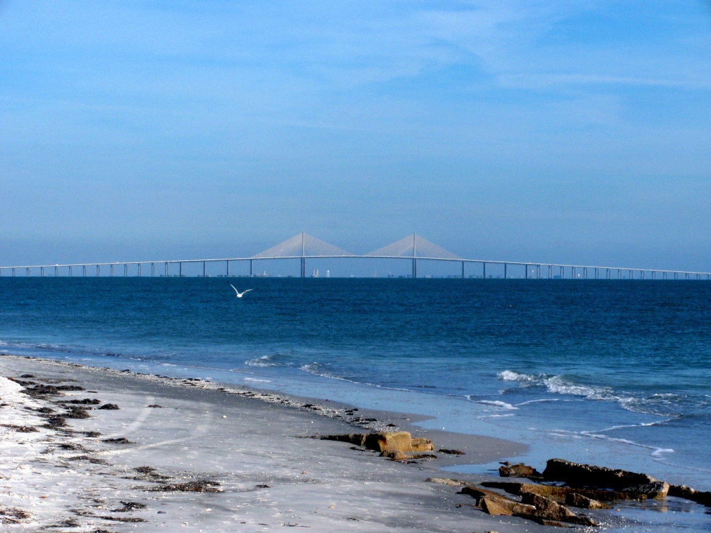
- Sunshine Skyway Bridge (I-275) — not a Tampa–St. Pete crossing. It runs south from St. Petersburg to Manatee County, toward Bradenton and Sarasota. It is a toll bridge, it is spectacular, and it is the reason Tampa is a midsize cruise port: every ship must pass under it, and the working air-draft limit is around 180 feet.
Distances from Tampa International Airport, by the airport’s own published figures: St. Petersburg 20 miles, Clearwater 20, Clearwater Beach 20 to 25, St. Pete Beach 27. None of that is far. All of it involves a crossing with one lane profile and no useful alternative when something goes wrong on it, which is why we would treat any cross-bay trip as a half-day commitment rather than a hop.
PSTA, on the other side
The Pinellas Suncoast Transit Authority runs buses in Pinellas County — St. Petersburg, Clearwater and the beach communities. The good news for a visitor is that Flamingo Fares works on both HART and PSTA, so one payment method covers both counties and the 31-day pass spans them.
The Cross-Bay Ferry: what is actually true
This deserves its own section because the outdated information is everywhere.
The previous seasonal Cross-Bay Ferry between downtown Tampa and downtown St. Petersburg ended service on 30 April 2025. It ran seasonally for several years and it is frequently still listed as a current option by guides that have not been updated.
A replacement is planned. Hubbard’s Ferry has been selected as operator for a service intended to run year-round, seven days a week, with two renovated ships, at fares expected to start around $10 one way with senior discounts — cheaper than the old service. The launch was targeted for the second half of 2026, contingent on the vessels arriving and being refitted.
As at September 2026, this is a planned service and not a confirmed running one. If a ferry crossing is something you want in your trip, check its current status directly before you build a day around it, and do not trust a guide page — including the dozens still describing the old seasonal schedule as though nothing had changed.
Driving: the default, and what it costs
Tolls, and the rental-car trap
Several of the roads that make this region quick are tolled: the Selmon Expressway across Tampa, the Veterans Expressway and Suncoast Parkway north, and the Sunshine Skyway Bridge south.
Florida runs two rates on every toll facility. The SunPass rate, paid with a transponder, is always the cheaper; the TOLL-BY-PLATE rate, billed from a photograph of your plate, is higher, and SunPass users save about 25% on average against it.
The trap: most major rental companies bill tolls to the card on your rental agreement using license-plate recognition — so you pay the higher toll-by-plate rate and then the rental company adds a daily convenience fee on top. Across a week that compounds. Either accept it, or set navigation to avoid tolls and accept slower surface roads. Rates were last indexed on 1 July 2025 and vary by facility and segment; use Florida’s Turnpike’s own toll calculator for your route rather than any figure printed on a guide page.
Parking
City of Tampa rates, which are the floor everything else sits above:
- Central Business District meters: $4 first hour, $3 each additional, enforced 8am to midnight, seven days a week.
- All other zones — Ybor City, Channel District, Hyde Park, Armature Works, Davis Islands, Grand Central — $3 then $2.
- City garages: $18 daily maximum at Ft. Brooke, W.F. Poe, Pam Iorio and the Convention Center; $14 at Twiggs, Centro Ybor and Palm Ave.
- Event rates override the standard table and run $5 to $50.
- The daily maximum resets when you exit, and next-day charges begin at 6am — so an overnight stay in a garage is two days, not one.
The arithmetic worth memorizing: a garage beats a Central Business District meter after about four hours. Four hours at a meter is $13, five is $16, six is $19 — against a $14 to $18 cap.
Rental cars
Tampa International’s Rental Car Center is reached from the main terminal by the SkyConnect automated train, which also serves the Economy Parking Garage. Peer-to-peer rental pickups such as Turo are restricted to the Economy Parking Garage only. The airport guide has the full arrival mechanics.
Our honest advice on whether to rent: if you are based downtown and your trip is a city trip, do not. The car will cost you a nightly hotel parking charge to sit unused while you ride a free streetcar. If your trip includes beaches, Busch Gardens or day trips, rent for those specific days rather than for the whole stay.
Taxis, rideshare and the late-night problem
Yellow Cab’s published rates are $3.50 for the first fifth of a mile and $2.85 a mile thereafter, with a $40 flat rate between the airport and downtown Tampa, and the same $40 to the cruise terminal, and a $22 minimum from the airport. Phone (813) 253-0121.
Rideshare adds a $5 airport service fee on airport pickups, with collection restricted to the Red Express Curbside, Blue Express Curbside or the SkyCenter One remote curb. Drop-offs are unrestricted.
Within the city, rideshare is plentiful and unremarkable until roughly 2am at weekends, when surge pricing out of Ybor City becomes the single largest unplanned transport cost of a Tampa trip. The 2am streetcar and the 3am last call guarantee a crush. Leave before it or wait it out.
Bikes, scooters and the Riverwalk
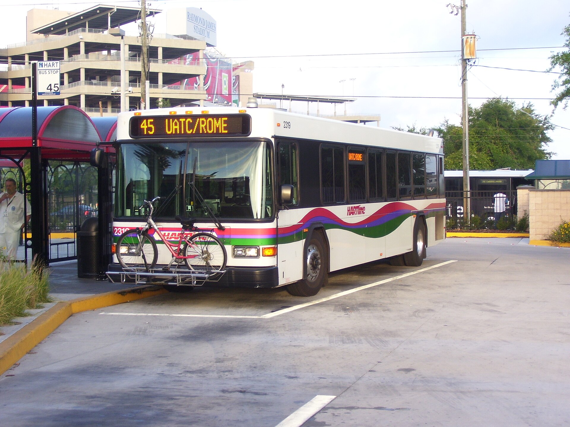
Bikes ride free on HART’s front-mounted racks, which is genuinely useful: it turns “bus to the general area, then cycle the last mile” into a single $2 fare, and it covers the gap that kills most transit trips in a spread-out city.
Shared bikes and e-scooters operate in central Tampa and are well suited to the Riverwalk corridor and the Channel District. Two cautions. First, scooter rules vary by district and by sidewalk, and enforcement in Ybor City and on crowded stretches of the Riverwalk is real — check the in-app restrictions rather than assuming. Second, this is not a city to cycle across casually: the corridors are excellent and the arterial roads between them are not.
Intercity: what exists
Amtrak serves Tampa Union Station, just northeast of downtown near Ybor City, with long-distance service up the eastern seaboard and south toward Miami. It is slow relative to flying and the station is small, but it exists and it is a genuine option for a one-way leg. Check the current timetable directly, as long-distance schedules change.
Intercity buses serve Tampa from the major national operators. There is no high-speed rail, no metro, no subway and no commuter rail in this region, and no rail link between the airport and downtown. Anyone arriving with expectations shaped by a European or Northeast Corridor city should recalibrate now.
Driving conditions a visitor should expect
Beyond tolls and parking, a few things about driving here differ enough from elsewhere to be worth saying out loud.
The afternoon storm is a driving hazard, not just a weather event
Between June and September this region takes 30.24 inches of rain — 61% of its annual 49.48 inches — in four months, and it arrives in concentrated afternoon downpours rather than in drizzle. What that means behind a wheel is sudden, dramatic loss of visibility, standing water on flat roads that drain slowly, and a great many other drivers braking hard at once. The correct response is to slow down substantially or pull off entirely. These systems usually pass within the hour, and waiting one out in a parking lot is a better use of twenty minutes than driving through it.
Hurricane evacuation routes are signed, and they mean it
You will see blue and white hurricane evacuation route signage on major roads throughout the region. In ordinary weather it is simply signage. During an actual evacuation those routes carry directional traffic control and the roads behave completely differently from the way a navigation app expects. If you are here during a named storm, follow county emergency guidance rather than your phone.
Sun, bridges and the things that catch people out
- Glare on the east–west arterials at sunrise and sunset is genuinely severe on a flat peninsula with a low horizon. Sunglasses are equipment here, not an accessory.
- The bridges have their own weather. Crosswinds on the high spans, particularly the Sunshine Skyway, are stronger than the conditions on either shore, and high-profile vehicles feel it.
- Interstate interchanges downtown are tightly spaced. Missing an exit on I-275 or I-4 near the city center often means a long loop back, so set navigation before you move rather than reading it at 60mph.
- Pedestrians and cyclists share arterial roads that were not designed with them in mind. On the Riverwalk and Bayshore the infrastructure is excellent; between them it is thin. Drive accordingly, and if you are the one walking, do not assume a crossing is where it should be.
Three days in Tampa without a car: a worked example
To show that the car-free claim is not theoretical, here is what it looks like in practice, with the running cost.
| Day | Movement | Transport cost |
|---|---|---|
| Arrival | Airport to a downtown hotel by taxi | $40 flat, shared between however many of you there are |
| Day 1 | Walk the Riverwalk; museums and the aquarium along it; streetcar to Ybor City for dinner; streetcar back | $0 |
| Day 2 | Streetcar to the Channel District; water taxi around the downtown stops; walk Bayshore at sunset | Water taxi day pass, or $0 if you walk |
| Day 3 | HART out to a further attraction and back, tapping a contactless card | $4.00, capped |
| Departure | Downtown to the airport by taxi | $40 flat |
Three full days of moving around for $4.00 per person, plus $80 of airport transfers split across your party. Against a rental car for the same three days — the daily rate, fuel, tolls and a nightly hotel parking charge — it is not a close contest, and it is the reason we push so hard on the downtown base in our where to stay guide.
The honest limit of this plan: it contains no Busch Gardens and no beach. Add either and you want a car for that day, which is exactly the recommendation — rent for the days that need it, not for the stay.
Five mistakes people make getting around Tampa
- Renting a car for a downtown city trip. It will sit in a paid garage while you ride a free streetcar past it.
- Planning around the Cross-Bay Ferry. The old service ended on 30 April 2025 and the replacement is not confirmed running. A large number of guides have not caught up.
- Confusing the Sunshine Skyway with the Tampa–St. Pete crossing. The Skyway runs south out of St. Petersburg toward Bradenton. For Tampa to St. Pete you want the Howard Frankland or the Gandy.
- Buying a day pass on HART. There is no need — the $4.00 daily cap applies automatically when you tap. Just tap a contactless card.
- Feeding a downtown meter all day. Central Business District meters run $4 then $3 an hour and are enforced until midnight. A garage caps at $14 to $18 and wins after roughly four hours.
Realistic trip times
We give distances rather than single drive times, and we will explain why: point-to-point times inside Tampa swing by twenty minutes or more with the hour, and any guide printing “14 minutes” is quoting a Tuesday at eleven in the morning. Distances do not move. Add the buffer.
| Leg | Distance | Mode | Buffer |
|---|---|---|---|
| Riverwalk end to end | 2.6 mi | Walk | 50–70 min at a stroll |
| Downtown ↔ Ybor City | ~1.5 mi | Free streetcar | 20–30 min door to door |
| Bayshore Boulevard | 4.5 mi | Walk or cycle | 90 min walking |
| Airport ↔ downtown | 9 mi | Car / $40 taxi | 25–40 min |
| Airport ↔ cruise terminals | 9.5 mi | Car | 30–45 min on a turnaround day |
| Airport ↔ Busch Gardens | 16 mi | Car | 30–45 min |
| Airport ↔ St. Petersburg | 20 mi | Car, cross-bay | 35–55 min |
| Airport ↔ Clearwater Beach | 20–25 mi | Car, cross-bay | 45–75 min, worse at weekends |
| Airport ↔ St. Pete Beach | 27 mi | Car, cross-bay | 50–80 min |
All distances are Tampa International Airport’s own published figures.
Accessibility, mode by mode
- The TECO Line Streetcar is level-boarding at its stations, and it is free, which removes the fare-payment step entirely.
- The Riverwalk is flat, paved and curb-cut for its full 2.6 miles. It is the most reliably accessible route in the region and it connects most downtown attractions.
- HART operates lift- or ramp-equipped buses and a reduced fare of $1.00 with a $2.00 daily cap for eligible riders. Eligibility and the paratransit application process are handled by the agency directly — contact HART rather than relying on a guide page.
- Rideshare wheelchair-accessible vehicle availability in this region is limited and unpredictable. If you need one, book a dedicated accessible service in advance rather than opening an app and hoping.
- Parking: the W.F. Poe Garage, which serves the museums and the children’s museum on Curtis Hixon Waterfront Park, has van-accessible spaces on levels 1, 2 and 4.
- Heat is an accessibility factor here, not merely a comfort one. A 2.6-mile walk that is trivially easy in January is a serious undertaking in August, when the normal high is 91.2°F.
What a day of moving around costs
| Approach | Cost per person per day | Where it works |
|---|---|---|
| Streetcar and walking only | $0 | Downtown, Channel District, Ybor City |
| HART, using the daily cap | $4.00 | Anywhere in Hillsborough County, with patience |
| Streetcar plus one rideshare | $10–25 | Adds Hyde Park, SoHo or Seminole Heights |
| Rental car, downtown-based | Rental plus hotel parking plus fuel plus tolls | Beaches, Busch Gardens, day trips |
| Rental car, parked in a city garage | Rental plus $14–18 plus fuel | As above, if your hotel does not include parking |
| Taxi, airport to downtown | $40 flat | Beats the meter and often beats rideshare |
The gap between the top row and the bottom rows is the whole argument. A visitor based downtown can move around for nothing. That is unusual for an American city of this size and it is the single most useful thing to know about Tampa.
Frequently asked questions
Do you need a car in Tampa?
Not if you stay downtown or in the Channel District and your trip is a city trip. The fare-free TECO Line Streetcar covers downtown, the Channel District and Ybor City, the Riverwalk is 2.6 walkable miles, and HART caps at $4 a day for everything else in the county. You need a car for Busch Gardens, the Gulf beaches, anything across the bay and any day trip — so rent for those days specifically rather than for the whole stay.
How much is the Tampa streetcar?
Nothing. The TECO Line Streetcar has been fare-free since 2018. Eleven stations, a car every 15 minutes, about 25 minutes end to end between Ybor City and downtown. Hours are 7am–11pm Monday to Thursday, 7am–2am Friday, 9am–2am Saturday and 8:30am–11pm Sunday.
How much does a HART bus cost?
$2.00 for a single local or limited express trip, with a $4.00 daily cap and a $65.00 monthly cap. Eligible riders pay a $1.00 discount fare with a $2.00 daily cap and a $32.50 monthly cap. Because of the cap, two rides in a day is the most you will pay. Tap a contactless card through Flamingo Fares — no app or pass purchase needed.
Is the Cross-Bay Ferry still running between Tampa and St. Petersburg?
No. The previous seasonal service ended on 30 April 2025. Hubbard’s Ferry has been selected to operate a replacement — year-round, seven days a week, two renovated ships, fares expected to start around $10 one way — targeted to launch in the second half of 2026 once the vessels are in place. As at September 2026 that is a planned service, not a confirmed running one. Check its current status before planning around it; a great many guides still list the old schedule.
How do you get from Tampa to St. Petersburg?
By car, across the Howard Frankland Bridge on I-275 or the Gandy Bridge on US 92 from South Tampa. It is about 20 miles from Tampa International Airport. PSTA runs buses in Pinellas County and Flamingo Fares works across both agencies, but a bus crossing is a long undertaking. The Sunshine Skyway is not the Tampa–St. Pete bridge; it runs south from St. Petersburg toward Bradenton and Sarasota.
Does Tampa have a subway or metro?
No. There is no metro, subway, commuter rail or high-speed rail in the Tampa Bay region, and no rail link between the airport and downtown. The public transport that exists is the fare-free TECO Line Streetcar in a small downtown corridor, HART buses across Hillsborough County and PSTA buses across Pinellas. Amtrak serves Tampa Union Station for intercity travel.
Can you take a bike on a Tampa bus?
Yes. HART buses carry front-mounted bike racks and bikes ride free on them, which turns a bus-plus-cycle trip into a single $2 fare and neatly covers the last-mile gap that otherwise makes transit impractical in a spread-out city.
What is the cheapest way to get around Tampa?
Free, if your trip fits the downtown corridor — the streetcar costs nothing, the 2.6-mile Riverwalk costs nothing and Bayshore Boulevard costs nothing. Beyond that, HART’s $4.00 daily cap is the cheapest way to cover the county, and it undercuts a single day in almost any downtown parking garage.
Are tolls expensive around Tampa?
Individually modest, collectively worth planning for — and more expensive in a rental car. Florida charges a lower SunPass transponder rate and a higher toll-by-plate rate, with SunPass saving about 25% on average, and rental companies typically bill tolls at the higher rate through license-plate recognition and add a daily convenience fee. Use Florida’s Turnpike toll calculator for your specific route rather than any published figure.
Related Tampa Guides
- Tampa International Airport Guide — arrival, airsides, SkyConnect, on-airport parking and the published distances used here.
- Where to Stay in Tampa Bay — which areas are on the streetcar line and which commit you to driving.
- Tampa Riverwalk and Downtown Visitor Guide — the 2.6-mile spine, and the water taxi that runs alongside it.
- Ybor City Visitor Guide — the other end of the streetcar line.
- Tampa Bay Itineraries for Every Trip — the same distances, arranged into days.
- Best Day Trips from Tampa — where the toll roads actually take you.
- Tampa Nightlife and Live Entertainment Guide — the 2am streetcar against the 3am last call.
- Cruises from Tampa and Port Tampa Bay Guide — the Skyway air-draft limit, and why it matters.
- Best Things to Do in St. Petersburg Florida — once you have made the crossing.
- Best Things to Do in Clearwater Florida — over the Courtney Campbell Causeway.
- Best Beaches Near Tampa — and the parking at the far end.
- Best Things to Do in Tampa — most of which is on the free streetcar line.
- Shopping in Tampa Bay — which shopping districts the free streetcar reaches, and which need a car.
- Tampa Airport Parking Guide — rates, the SkyConnect, and whether to park or take a cab.
- Gasparilla Parade Route and Parking — the one day a year when none of the usual parking math applies.
Sources and verification
Transit fares, timetables and service status change more often than most travel information, and this region’s are fragmented across several agencies. Everything below was checked in September 2026 against the operating authority’s own published information.
- HART — the $2.00 regular one-trip fare with its $4.00 daily and $65.00 monthly caps, and the $1.00 discount fare with its $2.00 daily and $32.50 monthly caps, checked 19 September 2026. HART’s own fares URL returned a 404 on the path we tried, so these were verified through its current published fare information rather than by direct fetch of that page; confirm at gohart.org before travelling.
- Flamingo Fares Tampa Bay — the regional payment system spanning HART and PSTA, its accepted payment methods including contactless cards and mobile wallets, and the 31-Day Unlimited pass covering both agencies’ local and express service, checked 19 September 2026.
- Cross-Bay Ferry — the 30 April 2025 end of the previous seasonal service, the selection of Hubbard’s Ferry as operator, the intended year-round seven-day service with two renovated vessels, the approximately $10 one-way opening fare with senior discounts, and the second-half-2026 target launch, checked 19 September 2026. This is a planned service and we have not been able to confirm it is operating.
- TECO Line Streetcar — fare-free status since 2018, 11 stations, 15-minute frequency, the approximately 25-minute end-to-end journey and the full weekly timetable, tecolinestreetcar.org, checked 18 September 2026.
- City of Tampa Parking Division — on-street zone rates, the 8am-to-midnight seven-day Central Business District enforcement window, garage daily maximums, the $5–$50 event range, the 6am next-day start and the daily-max reset on exit, tampa.gov/parking, checked 19 September 2026.
- Florida tolls — the SunPass versus toll-by-plate rate structure, the approximately 25% average saving, the 1 July 2025 indexing and the rental-vehicle license-plate billing arrangement, floridasturnpike.com and sunpass.com, checked 19 September 2026.
- Tampa International Airport — published driving distances, SkyConnect, the Rental Car Center, the Turo restriction to the Economy Parking Garage, Yellow Cab’s metered and flat rates and the rideshare airport service fee, tampaairport.com, checked 19 September 2026.
- Tampa Riverwalk and Bayshore Boulevard — lengths, surfaces and access, tampa.gov, checked 18 September 2026. The “world’s longest continuous sidewalk” claim for Bayshore is contested and is presented as such.
- Tampa’s 3am last call — Tampa, Fla., Code sec. 14-150, checked 19 September 2026.
- Climate normals — National Weather Service Tampa Bay, 1991–2020 ASOS normals for Tampa International Airport.
A note on method and on what is deliberately absent. This guide is researched and written from operators’ and agencies’ published information and public records. It is not based on riding these services, a visit, an interview, or original photography, and nobody here has timed a HART connection with a stopwatch. We have not published individual bus route numbers, frequencies or timetables, because those change on a service-change cycle that outruns any guide page — use the agency’s own trip planner on the day. We have not quoted per-facility toll rates, because they are indexed annually and vary by segment; the operator’s calculator is named instead. And where a service is planned rather than running, as with the replacement Cross-Bay Ferry, we have said exactly that rather than describing it as though you could board it tomorrow.
Photo credits
The Sunshine Skyway Bridge seen from Fort De Soto: photo by Buddy431, CC BY-SA 3.0, via Wikimedia Commons.
A HART bus with a bicycle on the front rack: photo by Wslupecki at en.wikipedia, public domain, via Wikimedia Commons.